Trail Guidelines
For a better experience for yourself and others, we ask that all visitors please:
Be courteous to others. Let them know of your approach in a clear but friendly manner.
Reduce your speed around pedestrians and sharp corners.
Carry out what you carry in. Nobody likes litter on the Trail
Respect private property by staying on the Trail.
Dogs are allowed but must be leashed and under control at all times. Please model good behavior and leave no trace of their visit.
Obey posted traffic signs
Bicyclists must yield to pedestrians.
Feel free to take pictures and leave the plants, animals, and natural features alone. Do not feed wildlife.
Take time to enjoy the Trail’s natural beauty
Unauthorized motor vehicle vehicles are not allowed on the Trail
Hazards exist on the Trail. Wisconsin’s Recreational Use Statute 895.52 applies to your use of this Trail. Use the Trail at your own risk.
Background and Trail Description
The Three Eagle Trail Foundation, Inc. is a non-profit, community-based organization established to develop, construct and maintain a safe, family-friendly, biking, and walking transportation route connecting the Town of Three Lakes and the City of Eagle River. The Three Eagle Trail is supported, in concept, by the municipal entities of the Town of Three Lakes, the Town of Sugar Camp, the Town of Lincoln, and the City of Eagle River. The trail is a central component of a larger plan for pedestrian trail development by both Oneida and Vilas Counties as adopted by their County Boards in cooperation with the North Central Wisconsin Regional Planning Commission. The plans call for connecting north woods communities with safe pedestrian transportation alternatives to vehicular highway travel. Future connections to the Three Eagle Trail including trails leading to Land O' Lakes, Phelps, and St Germain from Eagle River are being developed by the Great Headwaters Trails and the Vilas Area Silent Sports Association. Also, trails connecting Sugar Camp, Rhinelander, and Monico to Three Lakes are being promoted by the Oneida County Biking and Walking Trails Council.
The non-motorized Three Eagle Trail is currently in two sections. The original section, completed in 2007, is 8.4 miles long, beginning in Don Burnside Park in Three Lakes and ending on Sundstein Road about four miles south of the fairgrounds in Eagle River. The newer section, completed in 2013, is 2.8 miles long and begins in Eagle River next to the Dairy Queen. It heads south from there to Section 9 Road. Both routes are off-road, pedestrian pathways surfaced with crushed, compacted limestone. It is an ideal surface for biking, walking, and running. Separating the two sections by about 1.5 miles are the asphalt surfaced town roads, Sundstein Road and Section 9 Road. The plan for the future is to connect the two sections with another off-road route. A more detailed description of the two existing trail sections follows.
The Trail from Three Lakes
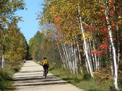
The south trailhead is located in Don Burnside Park just off of Highway A, west of the Three Lakes business district. There is ample parking near the pavilion which also has a water fountain and restrooms. From the trailhead kiosk, just south of the main park pavilion, the Trail heads east on the limestone path adjacent to the children's play area and tennis courts. Follow the path to the east end of the tennis courts where it turns northward onto a paved park access road. At the intersection with Gogebic Street turn right for about 100 feet and then turn left back onto the limestone surfaced trail. The Trail will pass between the Reiter Center on the left and the Three Lakes Winery on the right. It then winds around the Winery and heads north on the former Chicago & Northwestern rail grade. Use caution crossing Highway A at the edge of the Winery parking lot. Continue north on the trail as it follows the rail grade. At the intersection with Anderson Street, you may notice the first distance marker on the right side of the trail indicating that you have traveled 0.5 miles. Similar markers are posted every half-mile along the Trail. Their approximate location is also shown on the Trail Map. At the one-mile marker the trail is well separated from the highway. It crosses a wetland area that drains into the Thunder Lake Marsh.
Locals are willing to yield right of way.
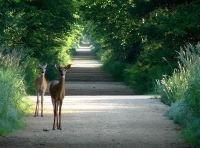
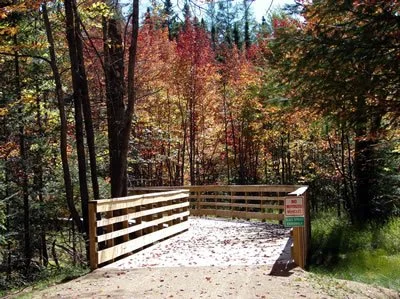
Just south of the 1.5-mile post you will encounter a traffic control gate. The opening is intended to be wide enough for a bike but restrictive to motor vehicles. Soon after the gate, you will reach the intersection of Rice Lake Road. An interesting side trip would be to take this gravel road west (to the left) about 0.25 mile to the Thunder Lake State Wildlife Area. There are no facilities there but it offers an opportunity to view birds and other wildlife in a large open area with multiple ponds and waterways leftover from what was once intended to be a cranberry marsh. Now, depending on the season, it can be a bountiful source of wild blueberries.
Northbound on the former Chicago & Northwestern Rail Grade.
Continuing north on the Trail, past Rice Lake Road, you will encounter another traffic control gate. In less than 0.5 miles the highway gets closer to the trail again, separated from the Trail by approximately 50 feet of mixed woodland and wetland.
At the intersection with Wykowski Road, the Petroleum Museum will be on your left. This is truly a unique place and a worthwhile visit. Continuing north on the Trail you will pass a small private pond on your left and, just south of the 3.5-mile post you will see the XC Ski Trail parking area for the Three Eagle Cross Country Ski trail. This is also the access point for a separate short but scenic snowshoe trail through a 40-acre parcel owned by the Board of Commissioners of Public Lands.
At the 3.5 mile post, the Trail turns left, away from the highway and through another traffic control gate. The next two miles of the Trail pass through private land owned by Gohlke Properties. The Gohlke's have generously permitted the Trail to traverse their land south of Clearwater Lake. Please respect the privacy of landowners by staying on the trail.
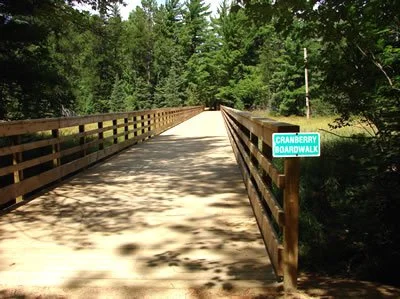
The Cranberry Boardwalk crosses a natural cranberry bog.
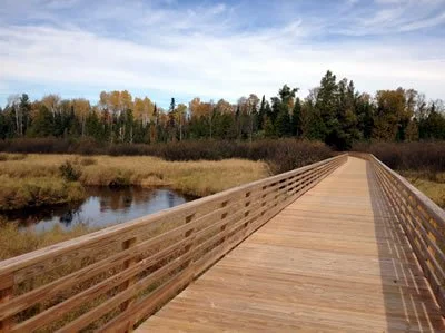
Just before you reach the 5-mile marker you will cross Cranberry Boardwalk, so named because it crosses a wetland in which wild cranberries have been found. Continuing on for another half mile, you will cross an area that is maintained as an easement for a buried gas pipeline and is also used as a snowmobile trail in the winter. You will also have reached the Black Spruce Boardwalk, so named because of the beautiful Black Spruce swamp that it passes through.
The Black Spruce Boardwalk in full Fall color.
The 5.5-mile post is actually attached to the railing of the Black Spruce Boardwalk and it is also approximately where the Trail leaves the Gohlke Properties and enters private lands owned by Tara Lila. For the next three miles, all the way to the Sundstein Road Trailhead, you will be passing through a small slice of the more than 600 acres of woodland and wetland formerly owned and managed by Wausau Paper Company. In 2007 the entirety of this acreage was purchased by Tara Lila largely to preserve a pathway for the Three Eagle Trail. Subsequently, additional hiking and snowshoe trails have been developed as public trails on private property.
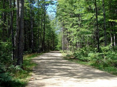
Much of the trail is forest land offering protection from sun and wind.
At the 6 mile marker, you will cross under the Wisconsin Public Service power line. And, in less than a half-mile you will reach the Mud Creek Bridge over, you guessed it, Mud Creek. This stream flows from Columbus Lake, about .75 miles to the west. It meanders through mostly wetland areas over several beaver dams, eventually joining the Wisconsin River just west of the City of Eagle River at Watersmeet Lake. The bridge affords a nice view of the Mud Creek floodplain which is home to a good variety of birds and animals. Just north of the bridge is the 6.5-mile marker. Soon after this point the trail leaves the flat, floodplain region and gains some elevation to a gently rolling portion of the Trail.
Shortly before you reach the 8-mile post you will see a privy on your left. This has been provided for the convenience of Trail users. Please treat it with the respect it deserves. When you reach the 8-mile post, if you look carefully along the left edge of the Trail you will see a tree with an attached drinking-water fountain. The water supply is delivered by a solar-powered pump which is housed nearby. Enjoy!
At the 8.4 milepost, you will pass through another traffic control gate at the Sundstein Road Trailhead. This is the end of the non-motorized south section of the Three Eagle Trail. If you want to continue north to the Eagle River section of the Trail you can take Sundstein Road north about 1.25 milestone to Section 9 Road. Turn right onto Section 9 Road and follow it for .25 mile to the trailhead on the left. The trail description for this portion of the Three Eagle Trail is written below from the opposite direction, heading south from Eagle River.
The Trail from Eagle River
The focal point of bike activity in Eagle River is the historic train depot at the intersection of Railroad Street and Wall Street. There are modern public restrooms in the building and plenty of parking space available. Getting to the Three Eagle Trail is quite easy. Just head one block south to the DQ.
The limestone pathway begins next to the Eagle River Dairy Queen and heads in a southerly direction along with the former Chicago & Northwestern railroad grade. Although the 12.7-mile post is located on the west side (your right while heading south) of the Trail, the 12 milepost and all subsequent distance markers are on the east (or left) side, every half mile. Along the way, you will pass through the first of several traffic control gates. The opening is intended to be wide enough for a bike and bike trailer but restrictive to motor vehicles. The Trail remains on the former railroad grade for a little more than a mile. It then curves slightly toward the southwest as it enters private property. Just past the 11-mile marker, the Trail passes around the western edge of the closed Town of Lincoln Landfill. Upon reaching the south side of the old landfill the Trail turns south onto private land owned by Tara Lila, LLC. Just past the entrance gate, after a sharp left turn, you will see the Tara Lila information kiosk on your left. It includes information about Tara Lila including a map/brochure which shows the hiking and snowshoe trails.
Four Women Boardwalk in late fall.
Right after the kiosk is the Four Women Boardwalk. It is an extraordinary, 660-foot structure, spanning Mud Creek and its surrounding floodplain. The boardwalk is named in honor of the wives and mothers of the two men most responsible for the development of this section of the Trail.
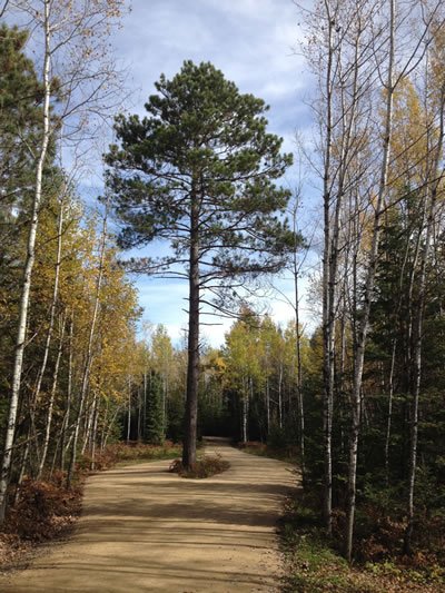
After the boardwalk, the trail gradually gains elevation as it winds through a densely wooded area. A highlight along the way is the Red Pine Circle where the trail actually splits to showcase an exceptional specimen of this Northwoods native tree species.
At mile 10, just north of Section 9 Road, is a picnic area complete with two tables. This is also the location of a parking area for motor vehicles in winter to facilitate access to the Medicine and Ah-My-Tab-Ha snowshoe trails. Just past the picnic area are another Tara Lila informational kiosk and a traffic control gate before Section 9 Road. This is the end of the non-motorized, north section of the Three Eagle Trail. The southern, non-motorized section of the Trail can be reached by traveling west (right) on Section 9 Road for .25 miles to Sundstein Road and then proceeding south (left) on Sundstein for 1.25 miles to the Three Eagle Trailhead. There is a somewhat confusing intersection at the stop sign where Apple Valley Road goes off to the east (left) and Sundstein Road continues both south (more or less straight ahead) and west (right). To get to the Three Eagle Trail you should continue almost straight as the road curves slightly to the left. The description for the southern, 8.4-mile portion of the non-motorized trail is provided above. It is written from the perspective of starting from Don Burnside Park in Three Lakes and heading north.